


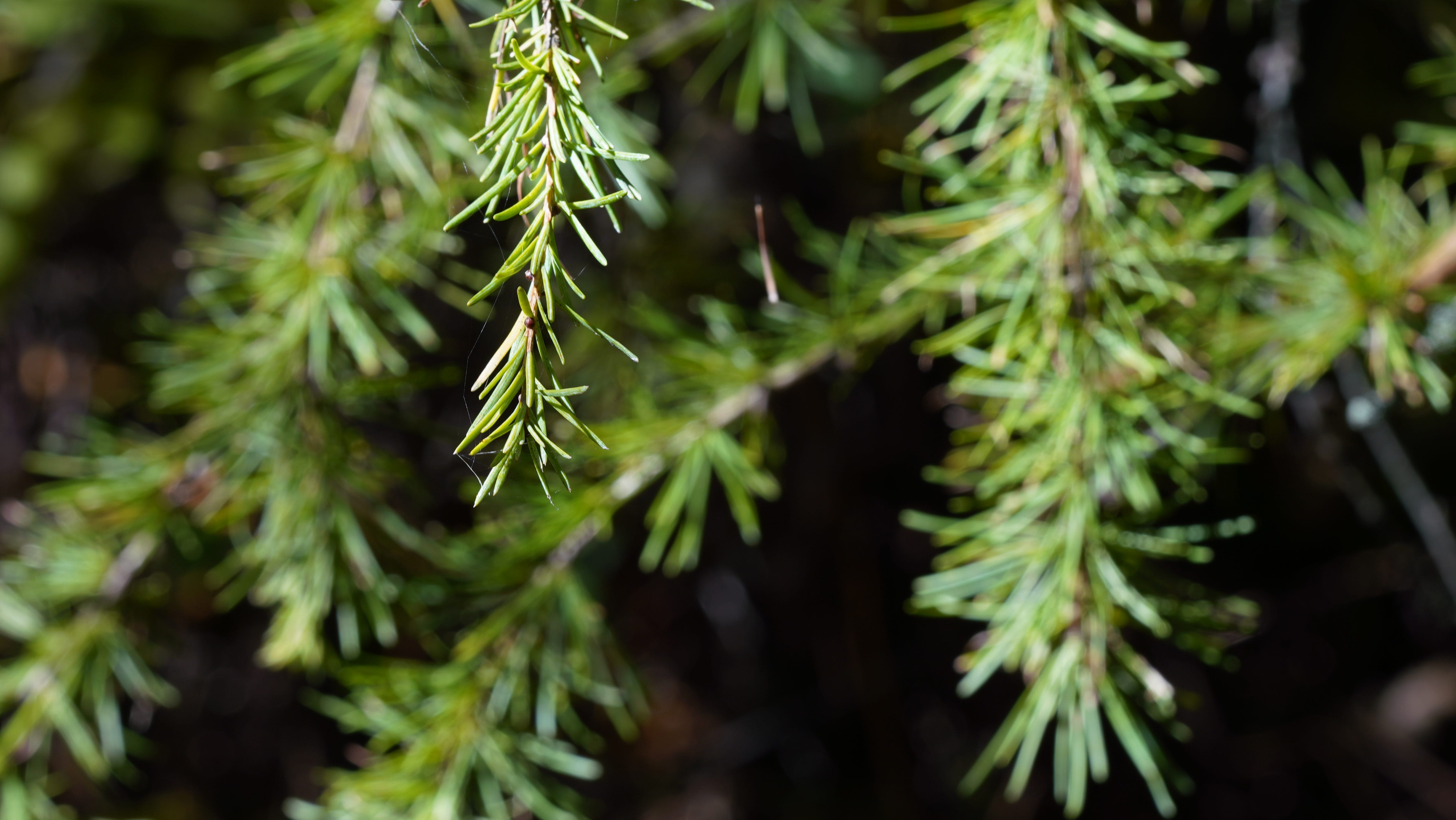
The area northwest of Chicago is a special place. Many waves of glaciation raked over the area for eons. As land and water receded and accreted and did so again, rough patterns began to form.1
Unlike much of the Chicagoland area, this is a rocky, hilly terrain, with freshwater springs left by the waning days of glaciation. The creeks run free and the water is clear, some of the highest-quality in the state. The fens are hanging. The tamarack bogs were some of the southernmost in the United States, so wild and unusual was this parcel straddling Illinois and Wisconsin. The Chain O Lakes and Fox River Valley rest in the low spots between the bigger moraines.
The area around Hackmatack National Wildlife Refuge is covered in glacial drift—rock material transported by a glacier and deposited either directly by the ice, meltwater streams, or wind. Portions of the area are right on the border of the Illinoian and Wisconsinan glaciations. This might not seem like much, but areas to the east of Hackmatack were road-graded by glaciers once again in the Wisconsinan period. That didn’t happen in areas to the west.
The name “hackmatack” is derived from an Algonquian word meaning “wood used for snowshoes.” It was utilized by Indigenous makers for toboggans and canoe parts. The author Louise Erdrich calls tamarack bogs “the great Ojibwe pharmacy” for their teas for coughs, berries for snakebite, and willows for indigestion. The bogs outside Chicago wouldn’t be out of place in Minnesota, northern Maine, or the Cascades of the Northwest.
It’s a land of kettle ponds, marshes, shrub swamps, outwash deposits, woodland brooks, and peat-accumulating low spots. On the north-facing slopes, there are red oaks and trillium, the copses described as parklands by early visitors for their scattered trees. It’s typical moraine country, kettle-shaped hills and valleys, the latter often with ponds or lakes and no outlet. It’s in those isolated tarns that we find the Yellow-headed Blackbird, shown in this video, a scarce breeder east of the Mississippi.
Our new documentary, “Welcome to Hackmatack,” tells the story of the establishment of the refuge—the first within 100 miles of Chicago—and its nationally significant ecosystem along the Illinois-Wisconsin border. Dedicated in 2012, it has quickly grown to encompass 1,273 acres in McHenry County, Illinois, and Walworth County, Wisconsin. A 985-acre acquisition for the refuge in 2024 was the largest in the Chicago region in this century and created the third-largest conservation landscape in the region. Several parcels are already open to the public for recreational pursuits including birding and hiking.
I’ll continue to post updates here, but if you want additional information and updates visit the Friends of Hackmatack website to sign up. The expected completion date for the film is Spring 2027. Showings will take place in community settings and possibly on public television. Funding for this project comes from The Community Foundation for McHenry County’s Hackmatack Educational Fund.
‘Polling’ place
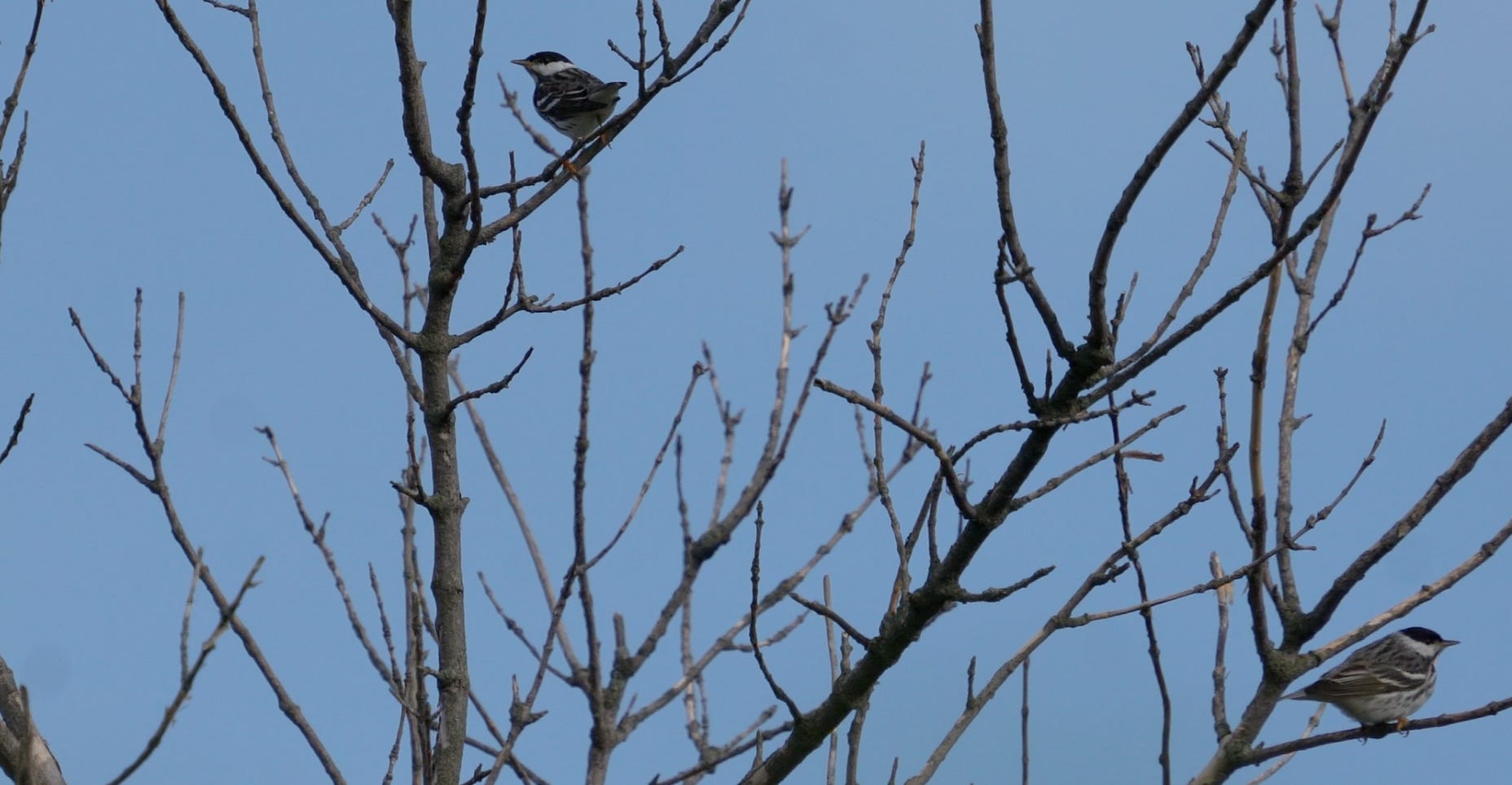
I was on the edge of the Hackmatack area months ago when a pair of songbirds landed in a lone tree in a meadow. My peripheral vision told me they were Black-capped Chickadees, but when I looked at them through my camera lens I realized they were Blackpoll Warblers—bigger, streaked, and with two white wingbars. It was a strange location for them, I thought, but in migration weird things happen. These are birds of the subarctic, breeding in the northern prairie provinces and Northwest Territories. But this particular spot in Illinois has more in common with the coulees and barrens of the Great Plains than the tundra-inflected bogs of the far north. I thought about why these two birds—both males—were together. Were they siblings from the same brood? Did they meet on the wintering grounds of South America, somewhere in the southern United States? The Blackpoll Warbler, especially the eastern birds, are known for a migration that has them zipping past the Gaspe Peninsula of the St. Lawrence and directly over the Atlantic Ocean toward Venezuela and Brazil. These two were on an interior course and might have come up through the Caribbean and Florida. It was one of those small moments in migration that could have easily gone by without a second thought.
Enjoying these posts? Not ready for a Substack subscription? Buy me a coffee through BuyMeACoffee.com. It’s a simple, low-cost, and one-time way to support my work.

A few of the sources that informed this post:
“Wedron and Mason Groups: Lithostratigraphic Reclassification of Deposits of the Wisconsin Episode, Lake Michigan Lobe Area,” Ardith K. Hansel and W. Hilton Johnson, Illinois State Geological Survey, Bulletin 104, 1996.
“Geology Underfoot in Illinois,” Raymond Wiggers, Missoula, Montana: Mountain Press Publishing Company, 1997.
“Books and Islands in Ojibwe Country,” Louise Erdrich, New York: Harper Perennial, 2014.
Thanks to Ed Collins, who appears in the teaser video, using the phrase “slow magic” to describe the subtle beauty of the Midwest.
SO interesting! When we lived in Lake County, our family spent a lot of time exploring Volo Bog, but we never got over to explore the Hackmatack area. How exciting it was however to see and hear my very first yellow-headed blackbird at our backyard feeders in Lindenhurst sometime during the early 1980’s. I was so surprised to see it that I might have even dropped my coffee! I’m looking forward to the documentary. Thanks again for sharing this.